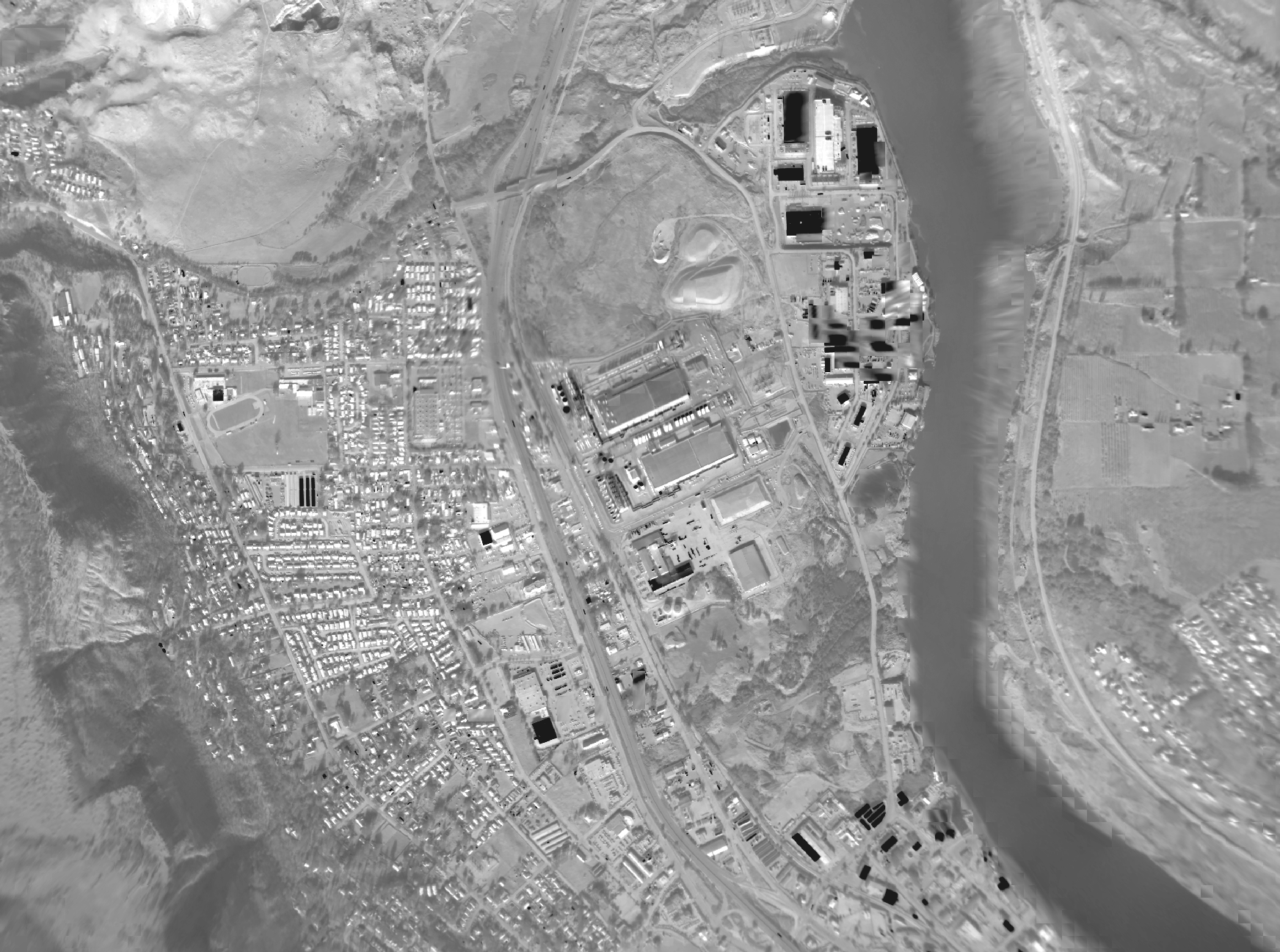
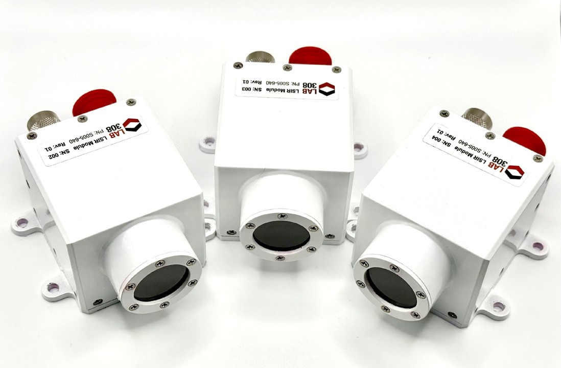
Clear HD Imagery
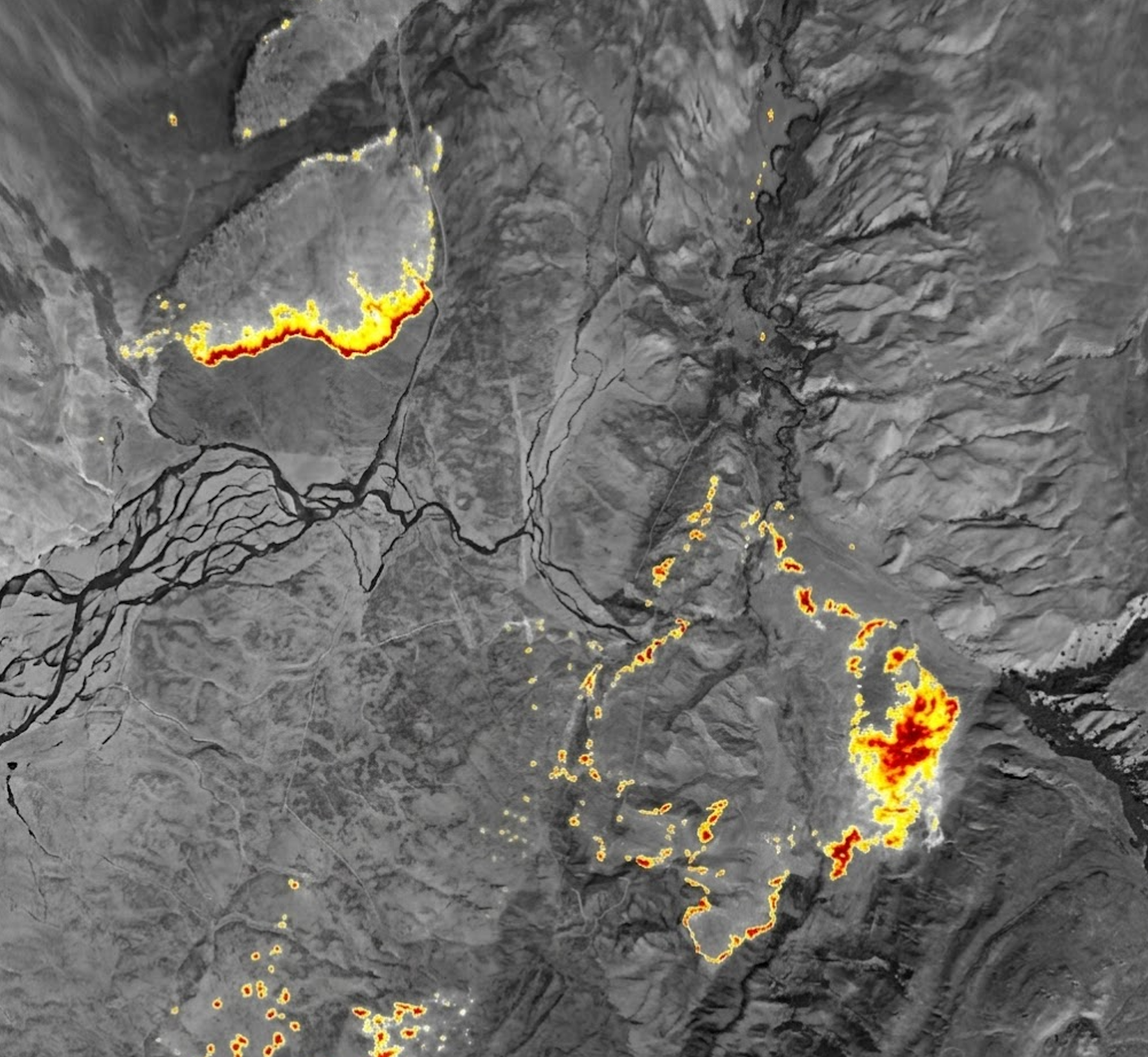
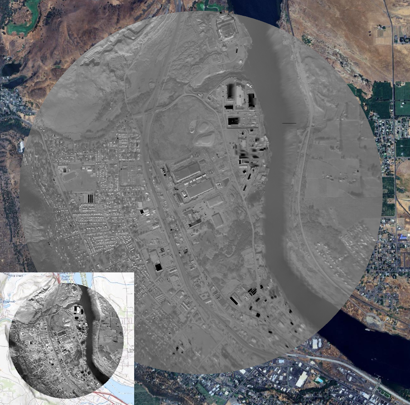
Built-in advanced infrared cores, these compact systems cut through smoke, haze and darkness—delivering crystal-clear situational awareness at affordable prices.

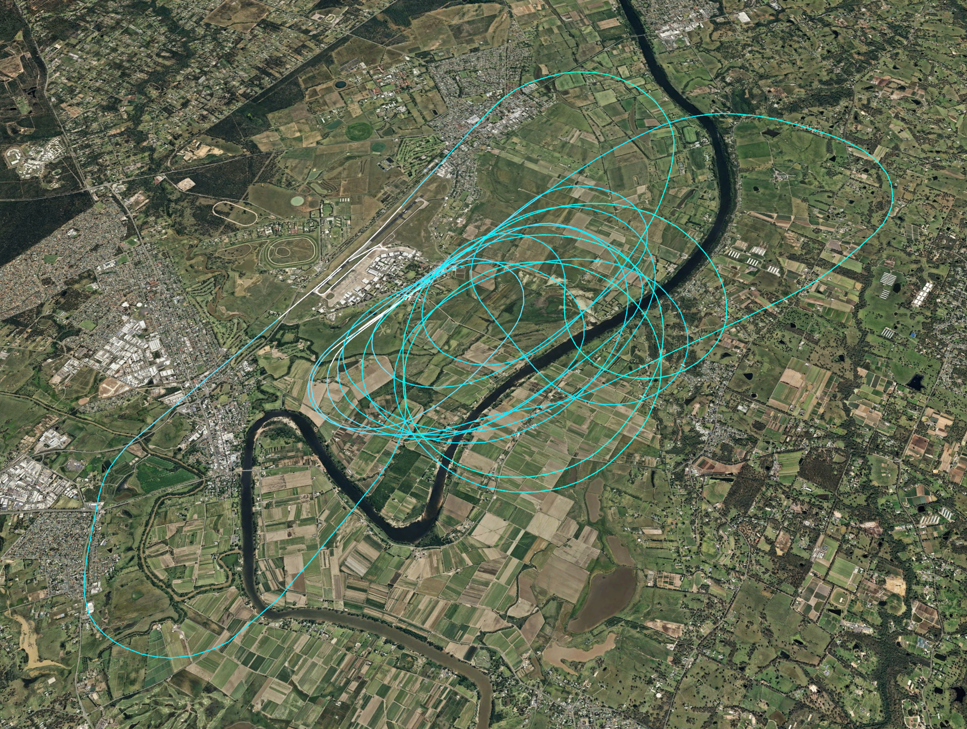
Always Geo Located
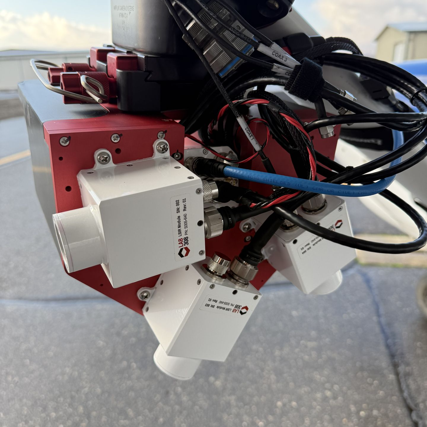
All our systems contain onboard GPS/INS for precise geolocation, anywhere, anytime. Onboard GPS can accept external digital GPS stream or be routed to an antenna. Lab 308 products never require GPS lever arm measurements, systems are self calibrating during flight utilizing advanced, image aiding techniques.
No Operational Changes
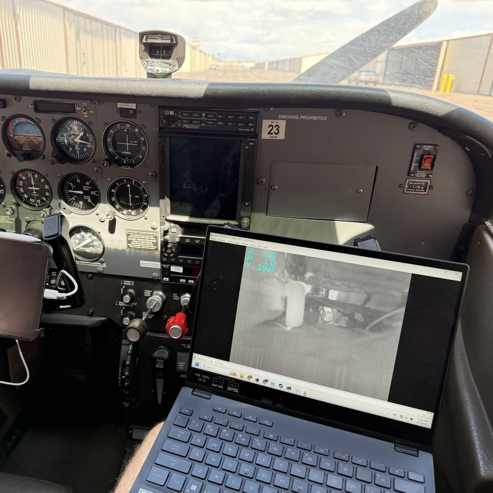
Units designed to easily integrate onto aerial fire platforms with no operational changes required. Fly any flight path you wish, passive imagers work in the background and collect images when available.
Our Story
Founded in Hood River, Oregon, Lab 308 is a cutting edge technology company working to improve aerial firefighting with smart infrared imaging. Founded by two tech entrepreneurs, who are engineers and problem-solvers at heart the company aims to give firefighters the real-time intelligence they need to battle wildfires more effectively and safely.
Lab 308 develops small video-based IR imaging systems designed to provide real-time intelligence without requiring operational changes. These systems provide live thermal mapping, hotspot detection and feed into predictive fire spread models, enabling faster and more informed decision-making from the sky.